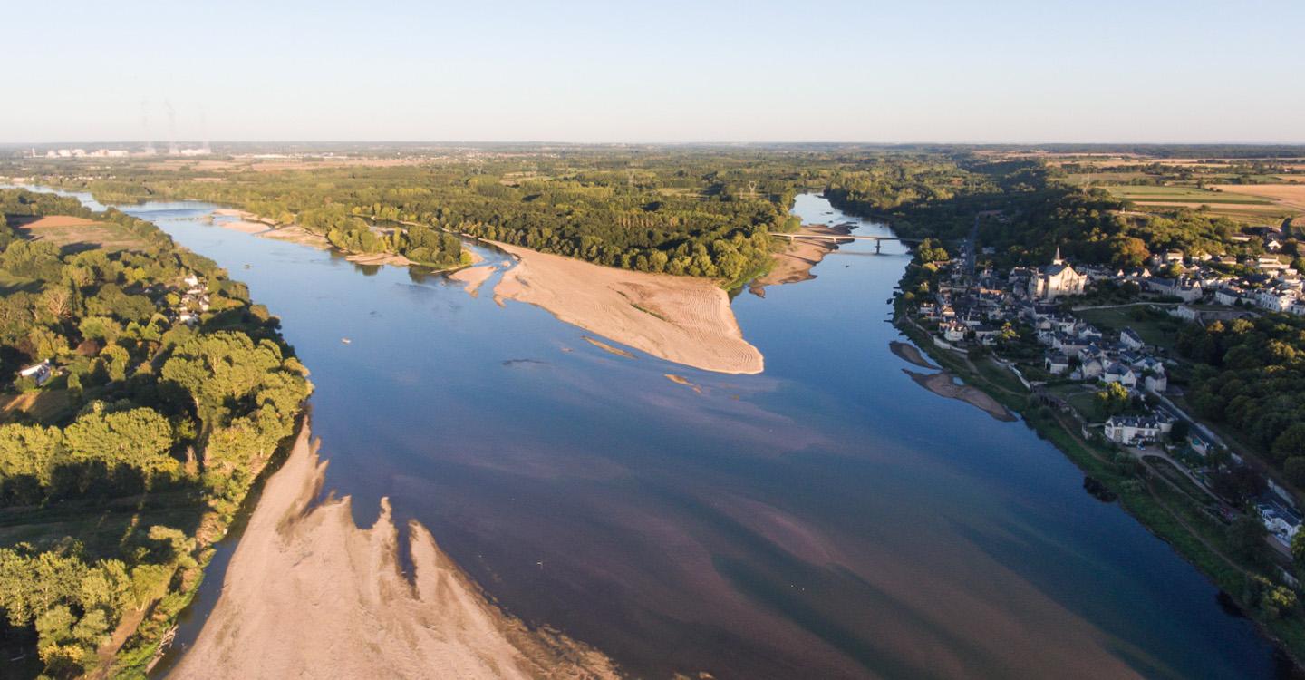
The Loire-Anjou-Touraine Park is situated on the westside of the “Val de Loire”. The Park name refers to the region stretching from the Loire valley near Orléans to the Anjou valley, which are larger than the Park area.
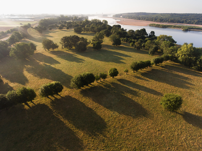
The term “valley” also names a specific kind of habitat: it is an area stretching along riversides, liable to flooding, on low altitude and rather flat which ends where the first relief elevations begin (plateaus, hillsides, …). It matches the floodplains; these are areas which can actually be inundated in case of a flood, whilst the riverbeds are areas where the water usually runs. So, the Park doesn’t have only one but several valleys. Just as many as the rivers and streams that run through it!
We also sometimes use the term “val” which names a part of the Loire valley where you find the biggest floodplains; as for example between Saint-Patrice (department 37) and Ponts-de-Cé (department 49), also known as the “Val d’Authion”. The Loire valley is widely open to oceanic mildness on the West and doesn’t know any harsh climate. The region is quite dry which favours wine growing. The many affluents to the Loire river (Cher, Indre, Vienne, Changeon/Authion, Thouet, …) have carved the surface of the plateaus and broken through the limestone bedrock.
Man has settled in the valley at very early stages. The most ancient traces date back to Gallo-roman times! Settlements were then set up on hilltops allowing people to escape from floods. It was not without risk to build houses in areas liable to flooding, but it gave access to many resources: food, building material, farmland, waterways, …
This soil occupation has gone hand in hand with deforestation and drainage, especially in the Middle Ages: alluvial forests have been cleared in order to develop livestock farming and, later on, farmland.
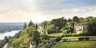
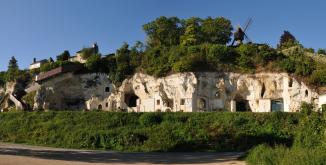
On the left bank of the Loire, tufa hillsides overlook the river – especially between Montsoreau and Saumur where they are up to 40 or 50 meters high. You can visit troglodytic caves transformed into wine cellars, museums or tourist accommodations there. On the right bank, the Val d’Authion is hidden behind the big levee of Anjou.

The prosperity of the “gardens of France”
Ever since the Middle Ages, the valleys have mainly been lands of agriculture. Over millions of years, the river has deposited sediments (sand, clay, silt) on the floodplains creating fertile soils. The mild and sunny Angevin climate and easy water access are to be added to this very rich soil. Man has transformed the landscape following his needs and available resources. Clearances have caused the disappearance of the alluvial forests in the valleys, except for some scattered woodlands. And once the levee of the Loire had been built, all the necessary conditions for the cultivation of fruits, vegetables, flowers, cereals, etc. in the valley had been satisfied.
The nearby Loire offers the possibility to rapidly export the products and goods as far as Belgium and the UK. Rich vegetable and horticultural productions emerge. This is why the territory of the Loire-Anjou-Touraine Park is also called “the gardens of France”!
The prosperity of this region along with the presence of rocks which can easily be extracted and sculptured also explains the beauty of local architecture. The river allows to transport building material between the different Loire harbours: tufa stone, slate from Trélazé…
In the 17th century, the valleys host the production of hemp which is used for making ropes for inland water shipping. In Anjou as well as in Touraine, its cultivation was growing. The area around Bréhémont and the lower valley of the Indre still testify of this ancestral activity. You can still find hemp ovens, retteries and barns there.
The Authion valley, from bocage to farm flatland
Today, the Authion valley is the perfect example for a landscape shaped by human activities. This territory is situated between Baugeois in the North-East part of the Park and the levee of the Loire. It has been subjected to the river’s tempers for a long time. For centuries, many streams have run through it. Forests and marshes have progressively been cleared and dried in order to develop subsistence corps.
Different constructions try to protect the Authion valley from floods, e.g. the bridge of Sorges built in 1732 or the displacement of the confluence Loire-Authion to Sainte-Gemmes-sur-Loire. Sadly, water continues flooding the valley year after year.
In 1967, Edgar Pisani, former Minister for Agriculture and also Minister for Equipment and deputy for Maine-et-Loire, initiates an ambitious project: transform these regularly flooded areas into polder (part of land reclaimed from the waters). This is where he created the flagship for horticultural production in France.
In order to regulate the water evacuation, different constructions, such as dams and ditches, are developed along the river allowing to dry the fields in winter and irrigate them in summer. The river has been modified so much that it ended up becoming a “disciplined canal”. Some parts have been left to stay more natural, such as the marsh of Brain-sur-l’Authion or the Lathan (affluent of the Authion) in Longué-Jumelles.
When strolling along the Authion valley, you will be surprises by the mosaic of cultivations spreading out under your eyes. Small fields neighbour big plantations and the productions are very diversified. You will mainly find cereal, horticultural and vegetable productions on this territory.
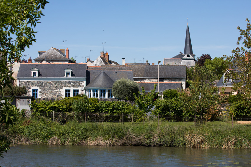
Village de Brain-sur-l'Authion ©N. Van Ingen
The bocage, a rural landscape in danger
The bocage is the Park’s emblematic landscape. It has been created and developed since the Middle Ages and is a mixture of farmland or meadows. Hedges, trees and ponds mark the boundaries between the fields. Settlements are fragmented; there are mainly farms and hamlets.
Hedges have been used by people for a long time, giving them fruit, construction material and firewood as well as fodder for the animals. They protect the cattle from bad weather, mark the boundaries of property and canalise flows. They are also shelter to a multitude of animal and plant species.
But after the Second World War, the modernisation of agriculture causes the disappearing of many hedges. Livestock farming becomes less profitable and is replaced by cultivations. In order to ease land use, small fields are merged and reallocated to create contiguous farms. People use the wood resource of the bocage a lot less for heating, etc. Hedges are no more boundaries and stay in the way of farming engines. Many of them are torn down.
The bocage is still present along the Loire river and in the lower valleys of the Vienne and Indre rivers. It is mainly made of meadows used for grazing and producing hay. It is liable to flooding which is a local specificity contributing to its natural richness.
Downstream the Chinon, the bocage of Véron is characterised by its double range of pollard trees. You can easily recognise these trees with big “heads”. Most of them are ashes. Their shape comes from regular cutting at 1,5 to 2m height. Each cut contributes to the thickening of the top of the trunk and designs a ball shape. This specific kind of cutting grows fire wood and wooden strips.
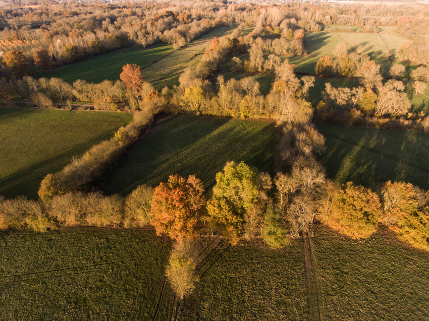
Vue aérienne du bocage en vallée de la Vienne, arbres têtards alignés aux couleurs orangées ©N. Van Ingen
Fruit farming: apples and pears of the territory
Fruit farming is an ancient tradition on the territory. But it is in the 19th century that groves are massively developed in the Loire valley. Today, you can find them in the Loire valley, near Azay-le-Rideau and around Saint-Remy-la-Varenne, Allonnes and Chouzé-sur-Loire.
You might already have eaten one of the numerous varieties of fruit of the region: a pear from Doyenné du Comice, an apple “Belle angevine”, “Patte de Loup”, “Reinette de Doué”, “Belle de Saumur”, “Pépin de Bourgueil”, …
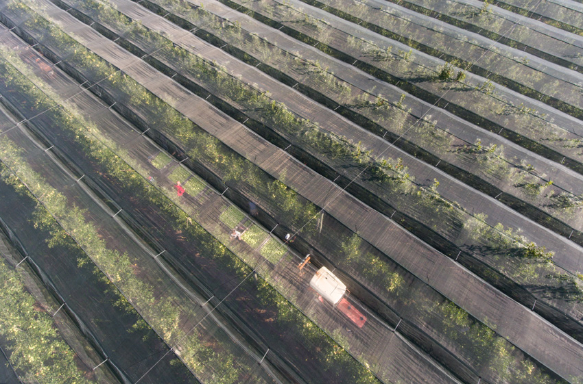
In the early 2000s, groves had to face several crises: overproduction, growing competition due to globalisation, … in order to enter new markets and cut down production costs, farmers start to grow new varieties such as the “Ariane” and “Pink Lady” apples or the Angélys pears. They also test new methods to protect the trees from climatic accidents. So, don’t be surprised if you see groves covered with hail nets.
Which is the best way to try local fruits? Of course, you can eat them as they are, freshly picked from the tree. But did you know that the pears and apples of the Loire valley can also be enjoyed as “fruits tapés” (dried fruit)? This ancient fruit conservation method has brought up one of the best delicacies of Touraine. “Fruits tapés » are dried, grilled and finally pressed. You can eat them as they are or rehydrate them in syrup, wine, … So, before you go, don’t forget to taste the dried apples of Turquant or the dried pears of Rivarennes !
©N. Van Ingen