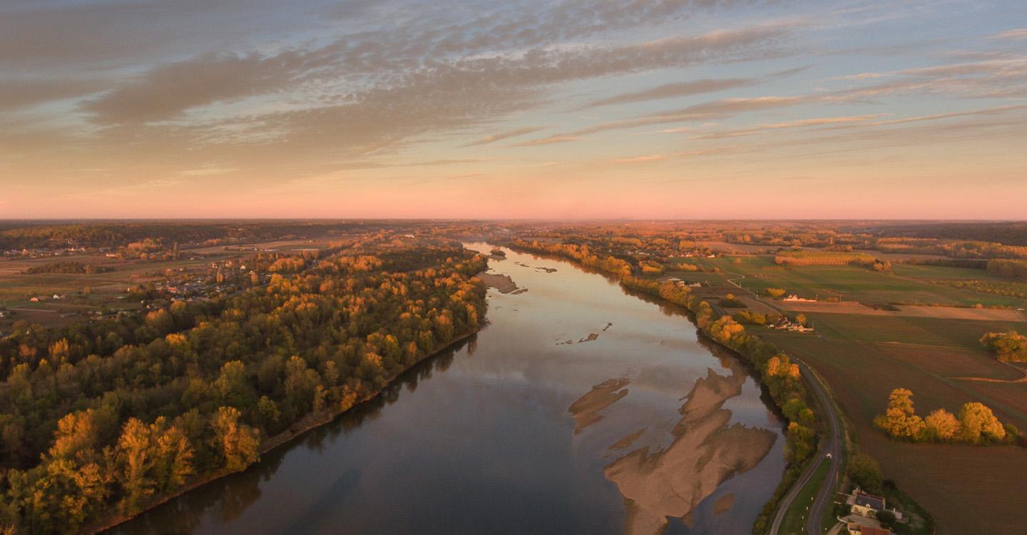
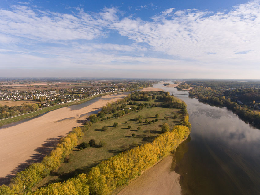
Oh, the Loire! The entire region’s history is inextricably linked to this emblematic river – the longest river of France. It springs in the Ardèche region, meandering over 1000 kilometres through 12 different departments before coming out into the Atlantic sea.
Many other streams run through the Park as well. All of them are affluents to the Loire: the Cher, the Indre, the Vienne, the Authion and the Thouet, and also the Layon in the Southern part of the territory. Water is all around, shaping green landscapes and contributing to the mildness of the local climate.
Due to regularly rising and falling water levels, the river and its affluents have deposited silt in the valley, fertilising the land. The rich soils make horticultural, vegetable, flower and other productions possible. You can also find livestock farming there: grazeland and mown meadows are also typical of the landscape along the riversides.
Right at the heart of the Park, the confluence of the Loire and the Vienne is a hotspot of the Loire valley. You can visit two of the “Plus Beaux Villages de France » (most beautiful villages of France) there: Montsoreau and Candes-Saint-Martin. In Candes, a belvedere on top of the hillside offers a panoramic view over the river and surrounding landscapes.
Each affluent has its own characteristics: the Loire, Vienne and Thouet easily overflow. The Indre is a much calmer river. And the Authion is the most artificial stream of the Park. It has been regulated in the 20th century to enable the development of horticultural and vegetable productions in the Authion valley.
Against popular belief, the Loire is not the “last wild river of Europe”. It has never been canalised to the same extent as the Rhin or the Rhône, but there are some permanent constructions (maintaining of a ship channel, confinement of the river, …). Historically, the Loire could flood the entire Authion valley. Since the 12th century, different constructions have confined it little by little between two levees.
A visitor strolling along the Loire river has a perfect view on them. The levee of the Loire is actually a national road today and can be up to 10 metres above water level. Take a closer look! The riversides of the Loire and its affluents have a great variety of landscapes and atmospheres to offer. There are a million different ways of enjoying them.
A complex river between the rises and falls of the water level
“Still waters run deep”: This could be the baseline to describe the Loire river and its unpredicable temper. Its hydraulic regime alone is a paradox : on the one hand the average flow is rather low, but on the other hand there are episodes of very important and often devastating. And in case of extreme cold, it can even freeze!
The water level of the Loire river is mainly influenced by rains. The overflows can be oceanic when caused by rains coming in from over the Atlantic sea. Or they can come after a so-called Cévenol episode when the rains arrive from the Mediterranean.
In the Loire-Anjou-Touraine Park, the Cévenol episodes can hardly be perceived, overflows come from the Atlantic side most of the time. The most spectacular events which can be observed on the territory are caused by the encounter of rains coming in from the Atlantic sea and those arriving from the Mediterranean.
These floods would not have any impact on people, if it wasn’t for them settling close to the river and streams. This choice can be explained by the presence of alluvial soils ideal for agriculture and livestock farming. But it also means dealing with the flood risk. How do floods occur?
- By overflow - when the river leaves its bed or when groundwater rises;
- By streaming in urban areas - when water cannot be absorbed because of impenetrable soils or the saturation of the rainwater evacuation system;
- By the breaking of levees - when dykes yield on increased water pressure;
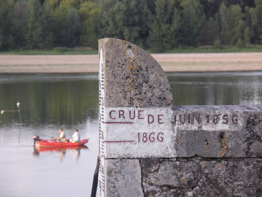
Open your eyes and you will see the flood reference marks on public buildings and houses, especially in Candes-Saint-Martin and Montsoreau. Sometimes, it’s a simple line on the wall, another time it’s a memorial plaque. In any case, these marks help to imagine the extent of damage caused by rising water and floods.
A glance at history: the construction of the “Loire levee”
Man has tried to protect himself from overflowing rivers ever since the Middle Ages. It was after the big flood of the Loire in 1150 that Henri II Plantagenêt, Count of Anjou and King of England, ordered the construction of a dyke all along the Northern part of the riverside. The so-called “trucies” made of earth, stakes and stones are reinforced and elevated. The Loire levee is aimed to protect the Anjou valley, allow the cultivation of its fertile soils and safeguard harvests. This construction has been lasting for seven centuries now!
Starting from the medieval parts, the levee has been extended, reinforced, elevated, … on a regular basis. Little by little, more and more settlements have been built along the levee. But the Loire has found itself far too contained between the dykes several times in the past: in 1707, the levee of Anjou bursts. The water covers the valley and kills several thousand people. In the 19th century, three once-in-a-hundred-years floods (in 1846, 1856 and 1866) cause several breaks along the dykes. In 1856, the levee of Anjou completely breaks in Chapelle-sur-Loire. Water invades the 150-meter large breach and covers the valley up to the town of Trélazé. With the floods, misery comes to the valley. Pay attention to the toponymy of certain places! “La Brèche” (the breach) in La Chapelle-sur-Loire and the “Détour de la Brèche” (detour of the breach) in Chouzé-sur-Loire are historical witnesses of these tragic events.
Today, the big levee of Anjou is 70 kilometres long and runs from Saint-Michel-sur-Loire (department 37) to Ponts-de-Cé (department 49). The departments of Indre-et-Loire and Maine-et-Loire are in charge of the maintenance and consolidation works in order to reinforce the dykes’ security and those of the riverside residents.
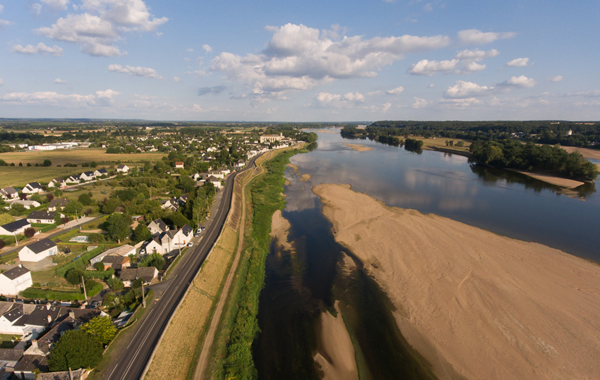
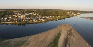
Sand exploitation and the decline of the Loire water level
In the past, the Loire deviated from its course between the two riversides. Today, it runs in a carved bed on much lower level. This lowering of the Loire water level is the result of constructions for navigation (construction of dykes and digging of a deep canal) as well as the industrial extraction of sand since the 20th century.
In order to satisfy the needs of the building industry, men have used the river resources to a large extent. This industrial use has increased the erosion of the riverbanks and therefore weakened civil engineering structures (bridges, old docks for inland water shipping, …). After the collapse of the pond Wilson in Tours in 1978, the extraction of sand from the Loire has been progressively prohibited.
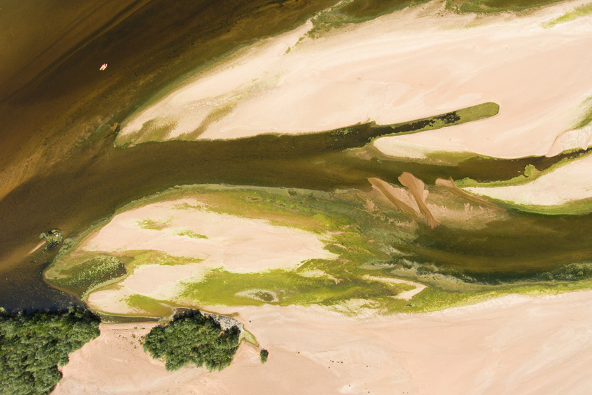
Sandpits have been moved from the rivers to the valleys. The rapid development of these sand quarries transforms the landscape and disrupts ecosystems. However, if these new biotopes were well developed, they could attract ducks and gooses hibernating in the region, but also tritons, frogs and other batrachians.
But let’s get back to the Loire: with the lowering of the water level, the river has disconnected from most of its hydraulic annexes. Almost all of the meadows liable to flooding, marshes and so-called “boires” (branches and ancient branches in which water runs only at some times of the year) are cut from the river during low-water level periods. Most of them are even completely without water!
But these wetlands host a very rich flora and are nesting areas for many animals. Their drying out clearly and directly puts fauna and flora in danger. Different restoring projects for the “boires” aim to give back their natural balance to these ecosystems.
The Loire and climate change
The first impacts of climate change can be observed in the Loire waters. A rise of temperature of 1,5°C has been registered between 1981 and 2003. This warming will continue to reach +2°C in 2050.
The Loire-Anjou-Touraine Park is particularly exposed to water shortness: the average annual rainfall on the territory is lower than the national average. So, in the near future, conflicts about water usage are likely to increase.
Although more and more popular, navigation on the Loire might become difficult in times of low-water level due to stranding risks.
But heat and a low water level also have other harmful effects: in 2017 and 2018, the presence of cyanobacteria has been observed in the Loire, the Thouet and Vienne waters, causing a substantial sanitary risk and the banning of fish consumption.
With the rise of outdoor temperatures, evapotranspiration is likely to increase and cause a significant decrease of the average rate of water flow as well as the rate in times of low-water level on the Loire river. The forecast for 2071-2100 predicts a decrease of the rate of flow in times of low-water level by -53 % compared to the last century. But for all that, the frequency of overflows of the Loire and its affluents should stay the same.
In this respect, restauration works on the “boires”, constructions aiming to regulate the rate of flow of the different rivers and streams, and the attention given to the balance between the different ecosystems will be crucial for the future sustainable management of the water resource.
An inventory of the flora of Savigny-en-Véron. Some comments are available on request.
For this botanical outing, we will explore the commune, its hillsides, its woods, the banks of the Vienne, in search of calcicultural plants...
 18 Apr. 2022 - 17 Sep. 2022
Au cœur du vignoble du village de Champigny, avec la vigneronne Marie-Françoise Ratron-Galet, partagez le quotidien et la philosophie du Domaine. Sans...